Hiking in Patagonia - Chile and Argentina
February 2-18, 2013
Part One - Chile
Page One - Flying to Punta Arenas, Chile
The afternoon of February 2, we flew from Denver, Colorado to Dallas, Texas
and overnight to Santiago, Chile. From Santiago the following day, we flew to
Punta Arenas with a stop in Puerto Montt. All of the photos on this page were
taken from the airplane.
The Andes origin goes back to the Cretaceous Period, which is a geologic period
and system from about 145 to 66 million years ago. In the geologic time scale, the
Cretaceous follows the Jurassic period. During this period, the Nazca Oceanic
Plate and the South American Continental Plate collided, causing the sinking and
slippage of the denser and heavier oceanic plate and, consequently, the folding up of
sedimentary rocks that covered the continental plate. The aftermath of this collision
created the Andes mountain chain and continues to be the cause of intense seismic and
volcanic activity. For the next 50 million years after the collision, the mountains continued
to rise but in the past 17 million years, erosion gradually wore down the summits. The southern
Andes are known as the Patagonian Andes. The name Patagonia comes from the word patagon
used by Magellan in 1520 to describe the native people that his expedition may have thought
to be giants. It is now believed the Patagons were actually Tehuelches with an average height
of 5'11" compared to the 5'1" Europeans of that time.
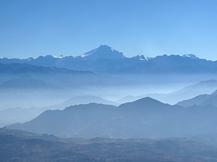
View from airplane of the Andes as we were nearing the Santiago Airport early morning February 3
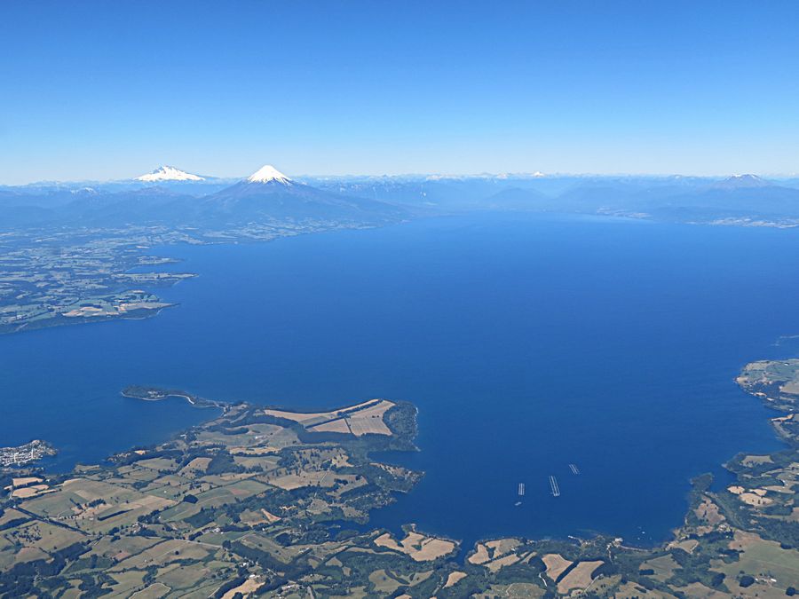
Puerto Montt area - Puerto Montt is the capital of the Lakes District. The Osorno Volcano can be seen
in the background behind Lago (Lake) Llanquihue. In the foreground you can see salmon cages in the lake.
Salmon farming in submerged cages was developed in a massive scale in the 1980s. Chile is the second largest
producer of salmon next to Norway, but the salmon industry was hit hard by the global recesion and an outbreak
of infectious Salmon Anemia. Salmon production dropped dramatically between 2005 and 2010,
but made a comeback
by 2012. As the geographic region's main port,
Puerto Montt is often considered the capital of Chilean Patagonia.
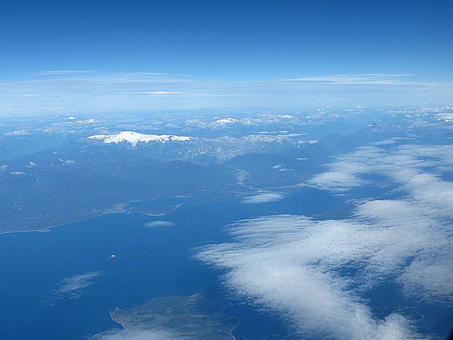
The Southern or Patagonian Andes on the way to Punta Arenas
Mountain view through the clouds
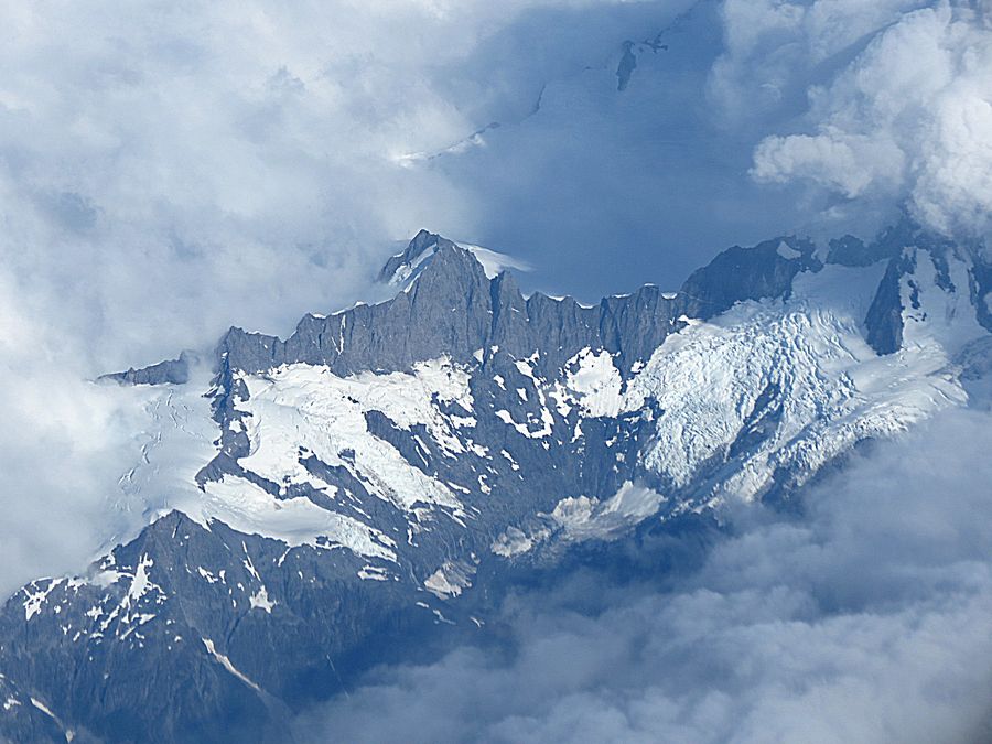
Glacier visible below the clouds
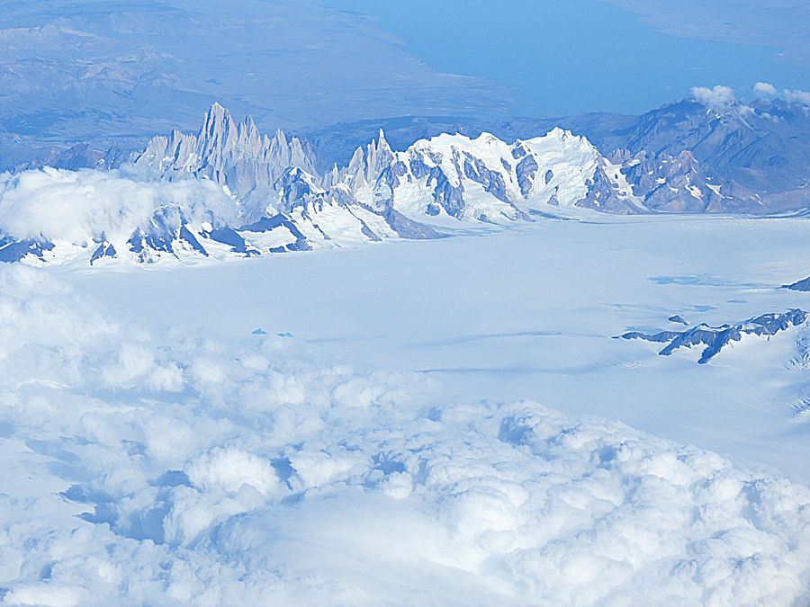
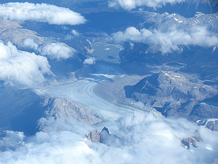
Unexpected, exciting view of Mt Fitz Roy (also known as Cerro Chalen or Cerro Fitz Roy).
It is located near El Chalten village in Argentina, in the Southern Patagonian Ice Field, on the
border between Argentina and Chile. First climbed in 1952 by French alpinists Lionel Torrey and
Guido Magnone, it is still among the most technically challenging mountains on Earth for climbers.
The Fitz Roy skyline is the basis of the Patagonia clothing logo developed after Yvon Chouinard's
ascent and subsequent film in 1968. It is 11,020 ft. in elevation. We saw Fitz Roy hiking and from ground
level when we were in Los Glaciares National Park in Argentina later in the trip. In the foreground, the
massive white white expanse is the Patagonian Ice Cap, the third largest Ice Cap in the world after
Antarctica and Greenland.
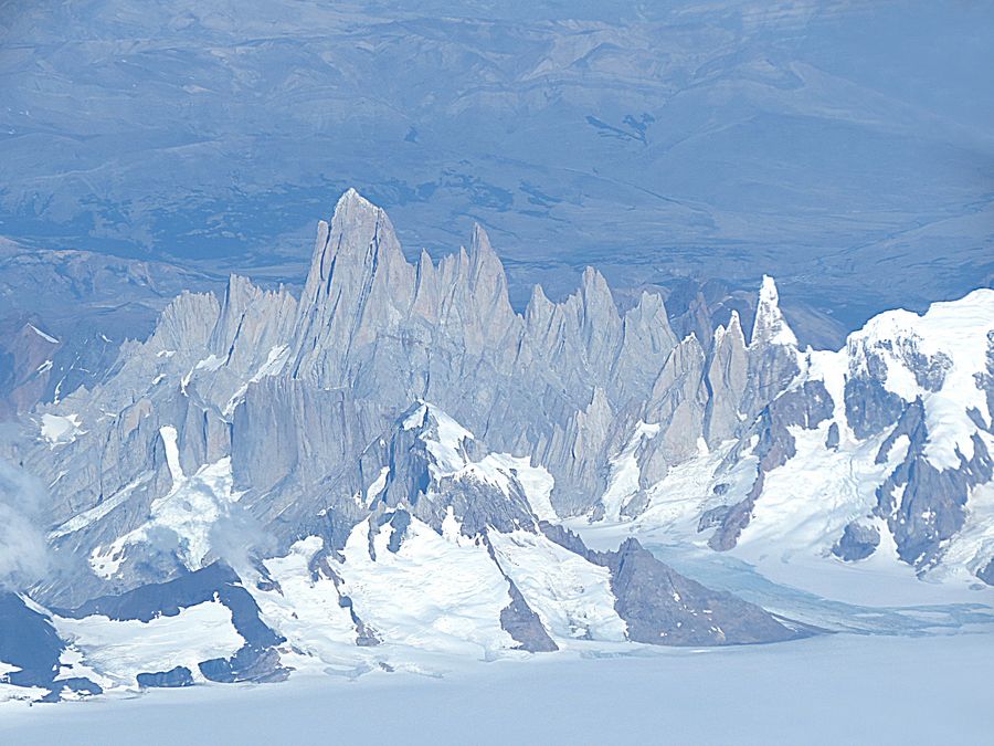
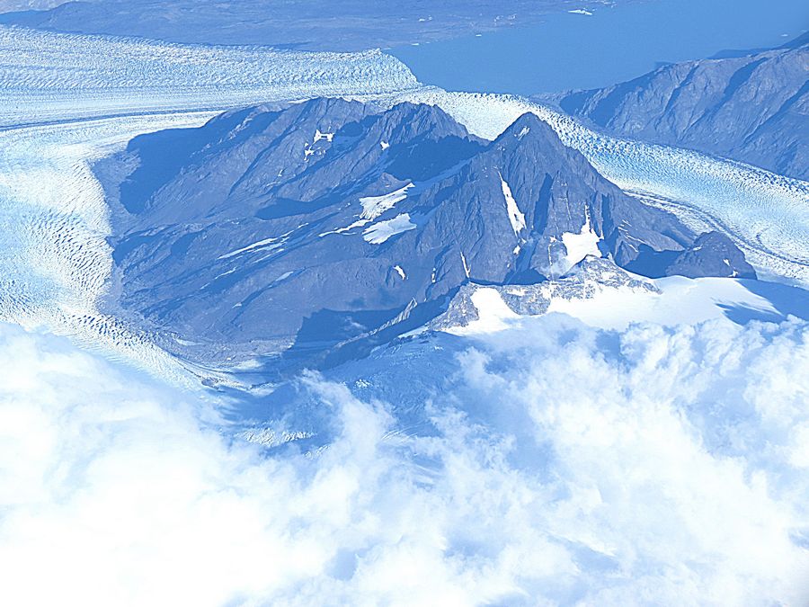
A closeup view of Mt Fitz Roy and Mt Torre. The snow capped, pointed peak to the right of Fitz Roy
is Cerro Torre, 10,262 ft. The mushroom shaped ice dome of Cerro Torre (Mt Torre) is a typical
glacial formation in the Patagonian Ice Fields. Cerro Torre is located in a region which is disputed
between Chile and Argentina. It is west of Fitz Roy. The ice at the top of the mountain is formed by
the constant strong winds, increasing the difficulty of reaching the actual summit for any climber. Cerro
Torre is considered the most difficult technical climb in the world.
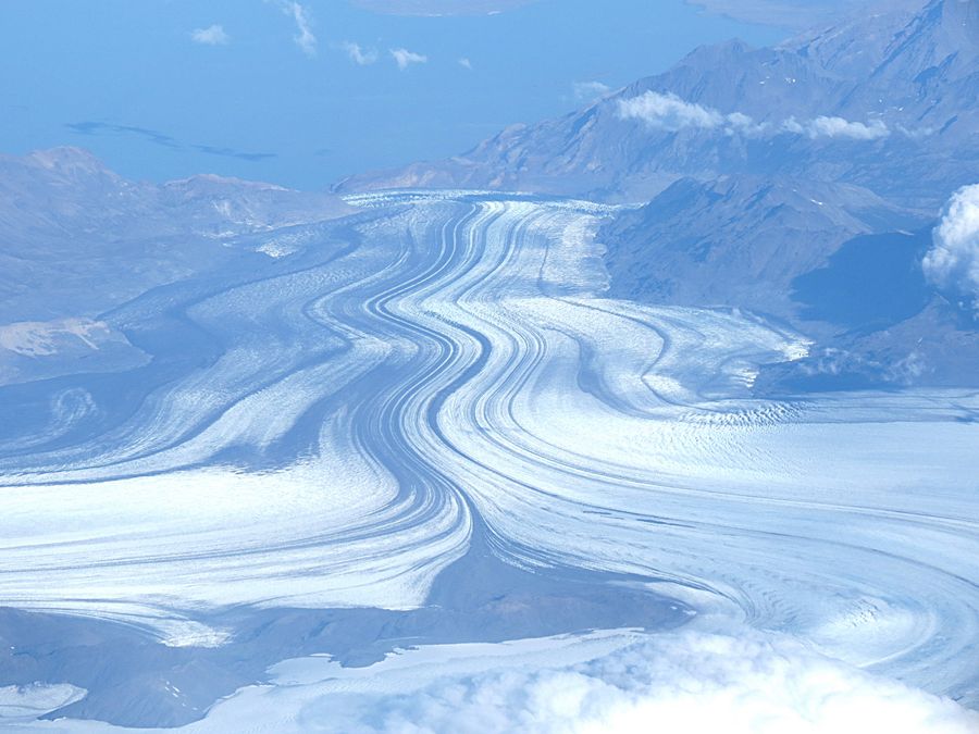
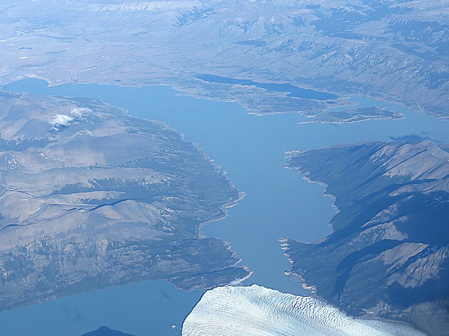
Viedma Glacier. The dark streaks are composed of stone fragments picked up by the glacier's
erosive action on the surfaces of surrounding mountains. Viedma is a large glacier that is part
of the Southern Patagonia Ice Field. It is a valley glacier, and its moraine rich terminus flows into
the western end of Lake Viedma, which is fed primarily by its melting ice. The glacier is located in
Los Glaciares National Park in Argentina. The Southern Patagonian Ice Field is 5,000 sq. mi.;
Viedma Glacier is one of the Ice Field's 48 outlet glaciers that have more than 7.7 sq. mi. of ice field each.
Crevasses, large, canyon-sized cracks, are in the grey-brown ice that can be seen along the sides of the glacier.
These cracks are formed from the stress arising between ice along the valley walls (that is slower moving
as the friction is greater) and the relatively fast moving ice at the glacier's center.
Glaciers are losing water and are being reduced rapidly.
46 of the 48 glaciers of the Southern Ice Field are decreasing at a record pace,
but Perito Moreno (next photo) is not one of them.
Part of Perito Moreno Glacier in Argentina. You can see a whisp of ice rising
from the glacier after an ice fall. We hiked on this glacier in crampons later in the trip. The
Perito Moreno glacier was named after the explorer Francisco Moreno, a pioneer who studied
the region in the 19th century and also played a major role in defending the territory of Argentina
in the conflict surrounding the international border dispute with Chile. The bare rock around the lake
to the right indicates the one time high water mark caused by periodic damming of the river system
by the glacier.
Link to Page Two - Punta Arenas, Chile
Pat's Home Page