Southern Africa - South Africa, Botswana, Zimbabwe, Zambia, Namibia
August 23 - September 15, 2016
Part Four, Page Two - Victoria Falls, Zimbabwe
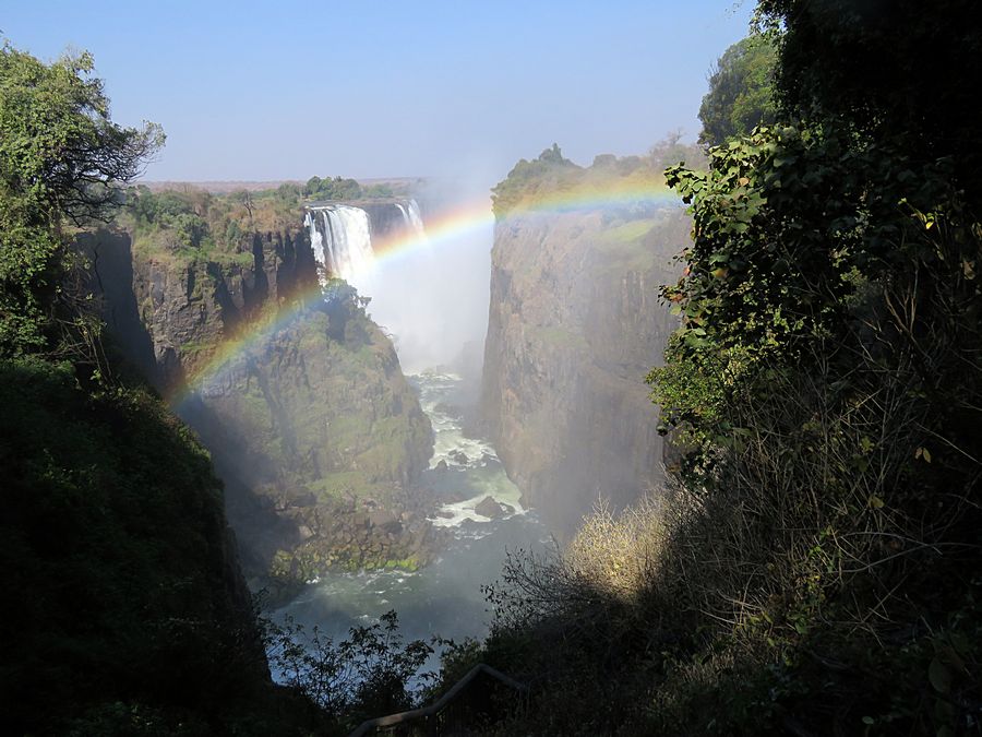
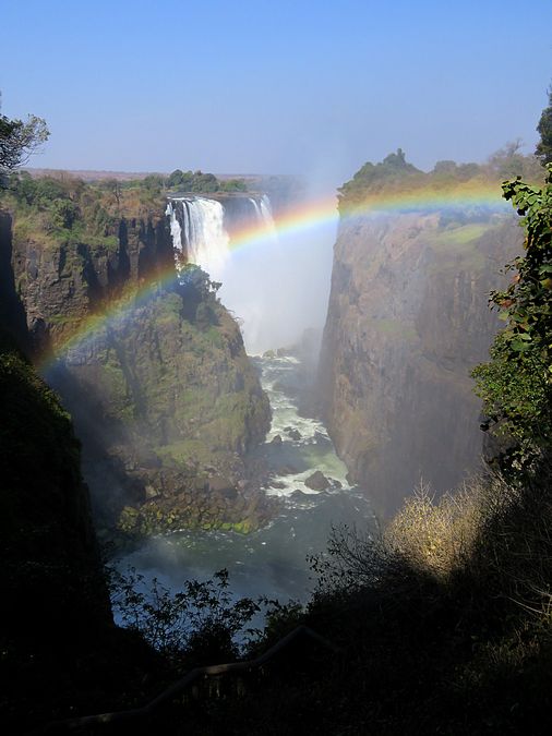
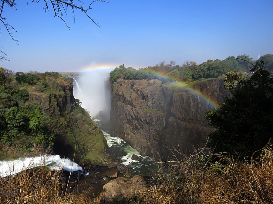
In Victoria Falls Park, at the west end. You cannot see the
entire length of the Falls at any one spot but can walk along the
opposite side of the gorge on a pathway to get various views of it.
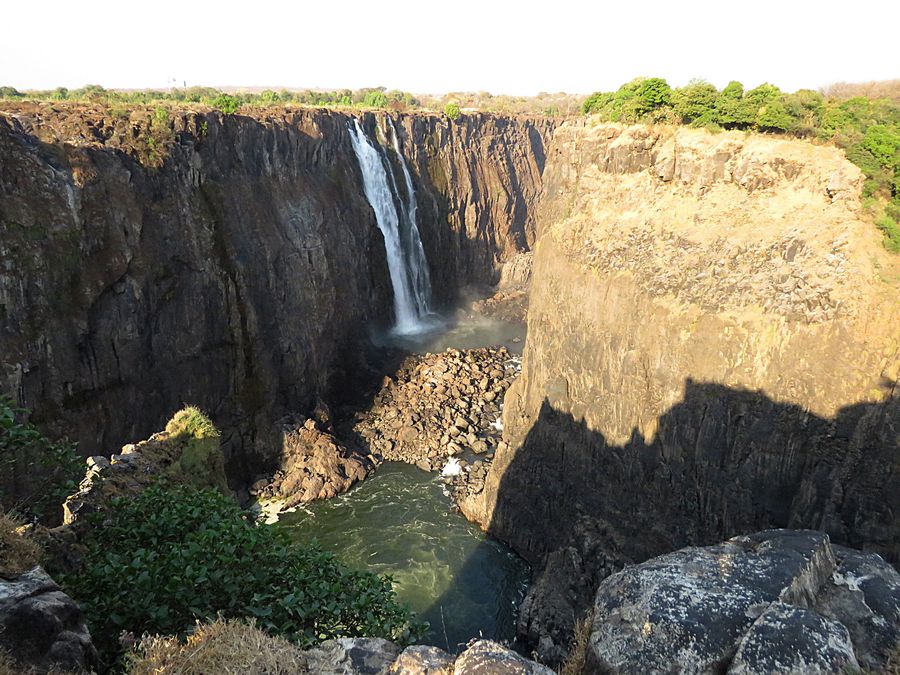
Looking toward the Main Falls. David Livingstone, the Scottish
missionary and explorer, is believed to have been the first European
to view Victoria Falls in November, 1855, from what is now known
as Livingstone Island, one of two land masses in the middle of the
river, immediately upstream from the Falls on the Zambian side.
Livingstone named his discovery in honor of Queen Victoria of
Britain, but the indigenous Tonga name, Mosi-oa-Tunya—"The
Smoke That Thunders"—continues in common usage as well.
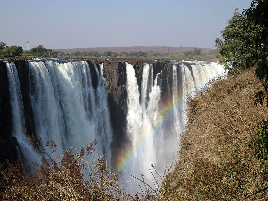
While it is neither the highest nor the widest waterfall in the world,
Victoria Falls is classified as the largest, based on its combined
width of 5,604 ft. and height of 354 ft. resulting in the world's
largest sheet of falling water. Victoria Falls is roughly twice the
height of North America's Niagara Falls and well over twice the
width of its Horseshoe Falls. In height and width Victoria Falls is
rivalled only by Argentina and Brazil's Iguazu Falls.
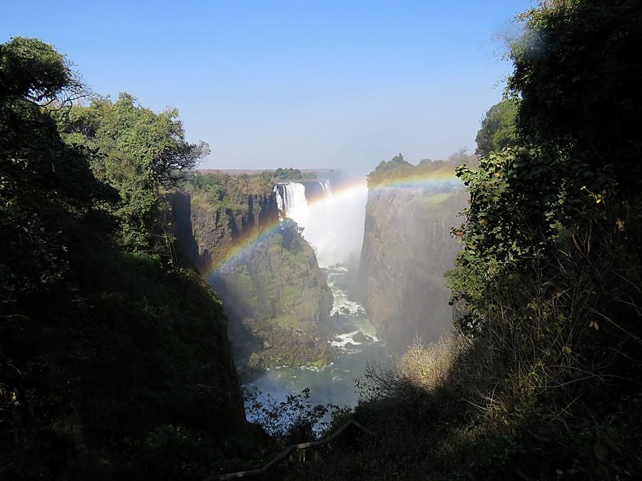

Cataract Falls in the foreground, part of Victoria Falls, and the Main Falls
in the background.
For quite a distance upstream from the falls, the Zambezi River flows
over a level sheet of basalt, in a shallow valley, bounded by low
and distant sandstone hills. The river's course includes numerous
tree-covered islands, which increase in number as the river
nears the falls. There are no mountains, escarpments, or deep valleys;
only a flat plateau. The falls are formed as the full width of the river
plummets in a single vertical drop into a transverse chasm 5,604 ft.
wide, carved by its waters along a fracture zone in the basalt plateau.
The depth of the chasm, called the First Gorge, varies from 260 ft.
at its western end to 354 ft. in the center.
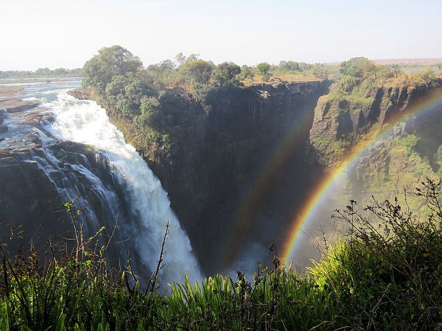
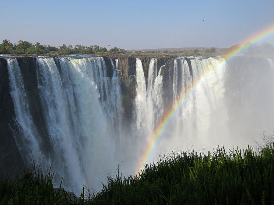
Devil's Cataract and Cataract Island with a double rainbow.
There are two islands on the crest of the falls that are large
enough to divide the curtain of water even at full flood:
Cataract Island (here) near the western bank, and Livingstone Island
near the middle. At less than full flood, additional islets divide
the curtain of water into separate parallel streams. The main
streams are named, in order from Zimbabwe (west) to Zambia
(east): Devil's Cataract, Main Falls, Rainbow Falls (the highest)
and the Eastern Cataract.
The Zambezi River experiences a rainy season from late November
to early April, and a dry season the rest of the year. The river's
annual flood season is February to May with a peak in April.
The spray from the falls typically rises to a height of over 1,300 ft.
and sometimes twice as high, and is visible from up to 30 miles away.
During the flood season, it is impossible to see the foot of the falls
and most of its face, and the walks along the cliff opposite it are in
a constant shower and shrouded in mist.
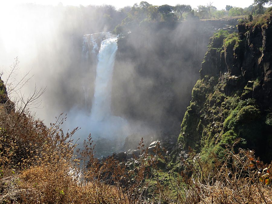
The Devil's Cataract, somewhat difficult to see because of the mist.
Protecting the camera was necessary even though it was dry season.
As the dry season takes effect, the islets on the crest become wider
and more numerous. In September to January up to half of the rocky
face of the falls may become dry and the bottom of the First Gorge
can be seen along most of its length. At this time it becomes possible
(but not necessarily safe) to walk across some stretches of the river
at the crest. It is also possible to walk to the bottom of the First Gorge
at the Zimbabwean side. The minimum flow, which occurs in November,
is around a tenth of the April figure.
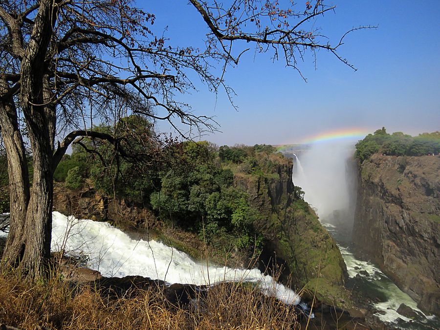
The Main Falls
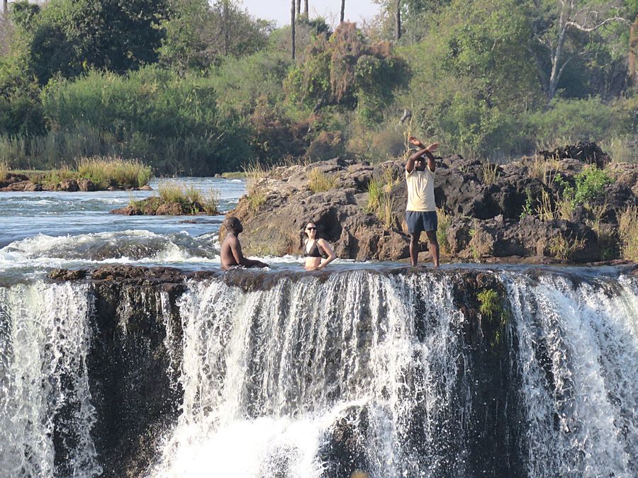
Across the way 3 people were wading. It was amazing that they could do
that so close to where the river was dropping down into the gorge in the
Main Falls area.
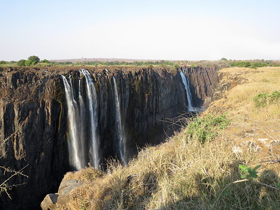
The drier end of the Falls looking toward Zambia
Tourists have to be careful at this spot, since there is no protection
from the long drop below.
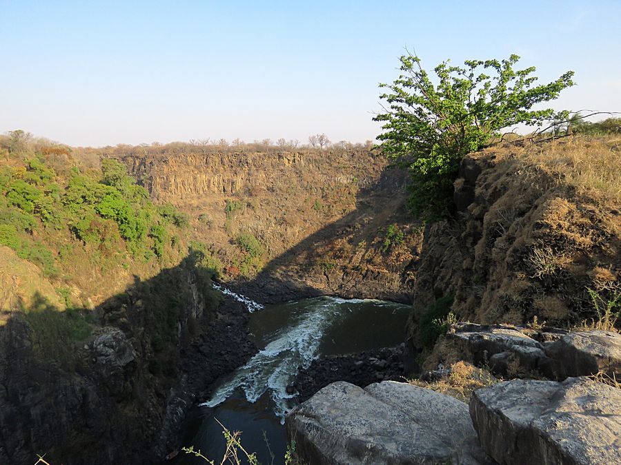
The entire volume of the Zambezi River pours through the First Gorge
for a distance of about 500 ft. then enters a zigzagging series of gorges
designated by the order in which the river reaches them. Water
entering the Second Gorge makes a sharp right turn and has carved
out a deep pool there called the Boiling Pot.

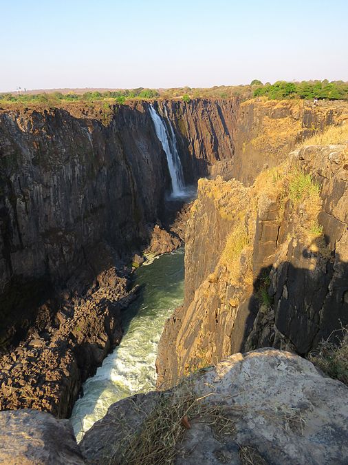
Eastern Cataract area of Victoria Falls, taken from the east end.
If you could look to the right, the Boiling Pot would be in view.
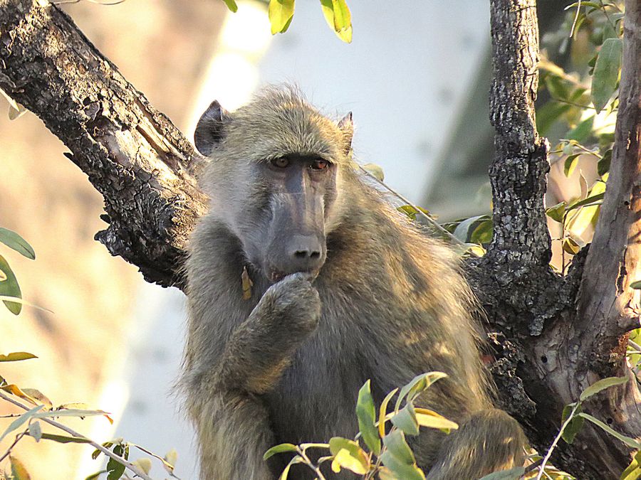
At the end of the pathway along the Falls and outside Victoria Falls
Park a baboon was in a tree. When I visited Victoria Falls in 2001,
(I was in Africa - Kenya, Tanzania, and Zimbabwe - on 9/11 and beyond)
baboons were running all over the Park, including the pathway. They
have since been chased away but are obviously nearby although I
did not see a single one in the Park.
.

The structure a ways behind the baboon is part of the
Victoria Falls Bridge that connects Zambia and Zimbabwe.
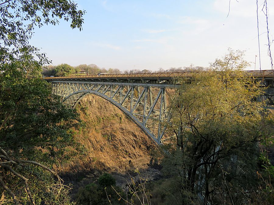
Victoria Falls Bridge from Victoria Falls Park, where the
Second Gorge is. A few days before this, we had walked across
this bridge when we were heading for Hwange National Park.

The next day, we went to a grocery store in Victoria Falls to buy food for our lunch
at the home of a local village chief. We were given a list of items to purchase,
and we were helped in finding those items by staff from the store. Everyone
learns English in Zimbabwe.
There are 16 official languages.
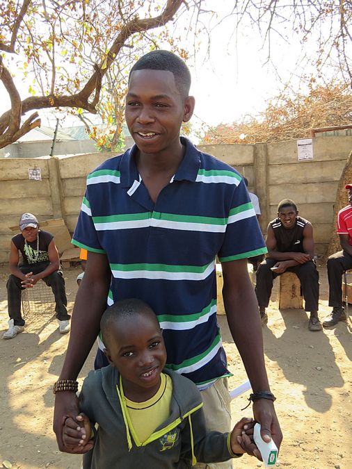
Near a local market, a young man and his son were interested in talking
to us.
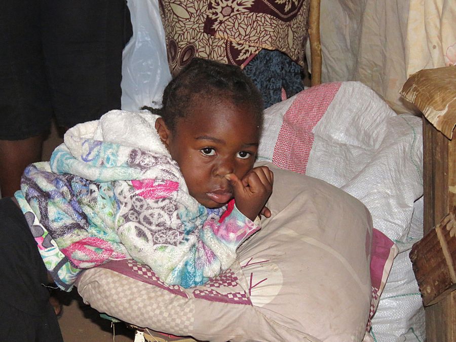
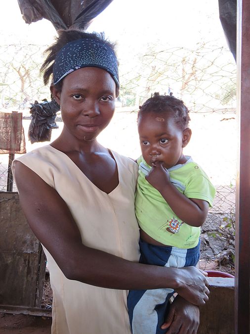
A vendor's baby at a local clothing market in Victoria Falls.
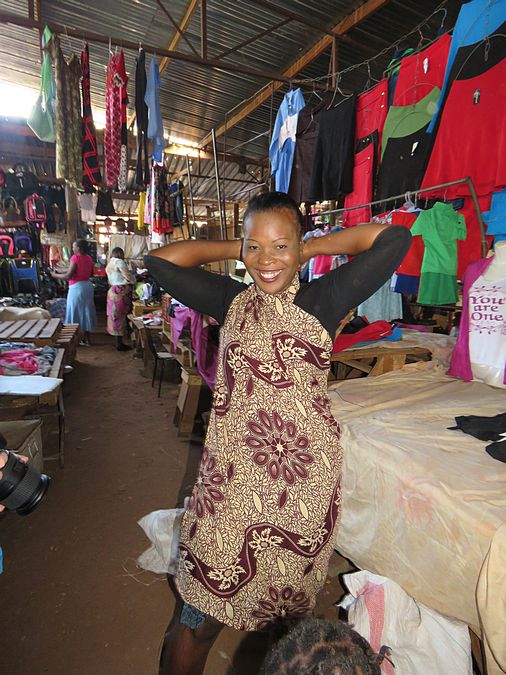
Mother of the baby shown above. We always asked if we could take
photos, and most were happy to oblige.
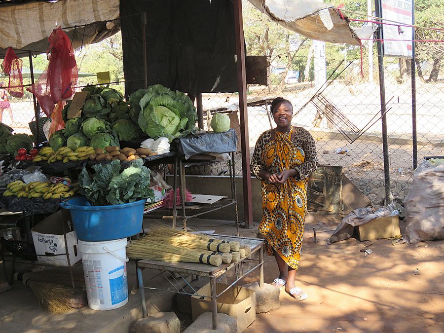
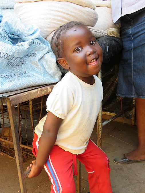
This is another local market selling basically fruits and vegetables.
Another vendor with her child.
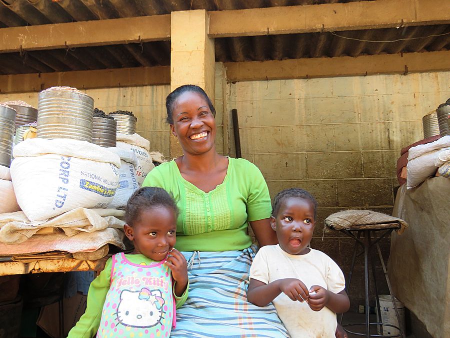
Mothers have their kids with them while selling.
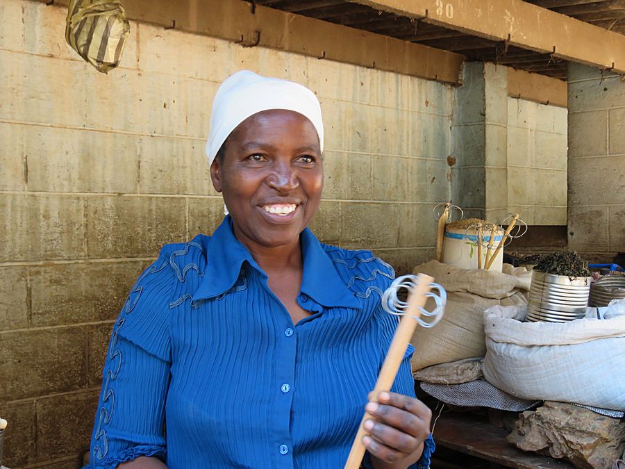
Cooking tool
Link to Part Four, Page Three - Victoria Falls
Pat's Home Page